Contour Maps of Water Levels and TCE Concentrations
for the Fruit Avenue Plume Site
Source:
Groundwater Sampling Summary Report
for the December 1996 Sampling Event
prepared by
New Mexico Environment Department, Ground Water Quality Bureau
April 21, 1997
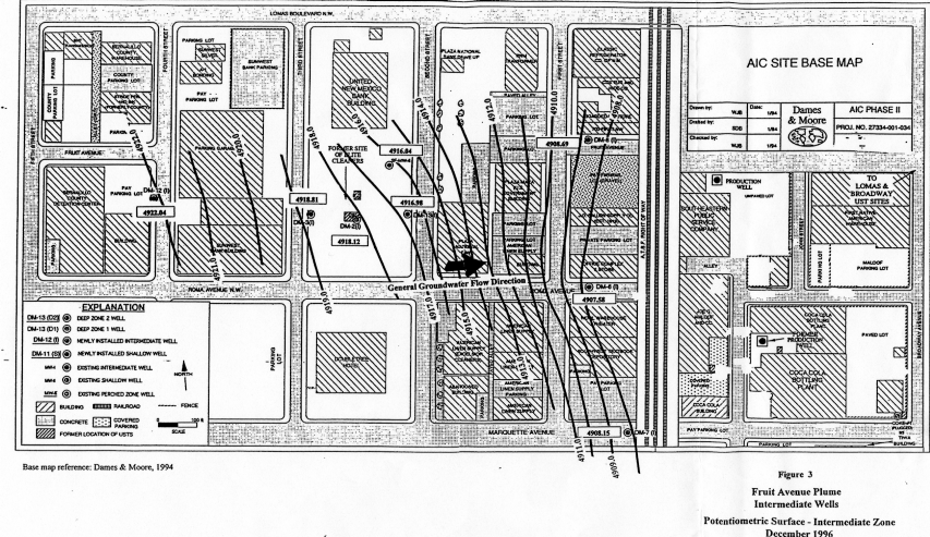
The following maps were "hand contoured" based on measurements
at observation wells, the locations of which are visible on the maps.
Potentiometric Surface, Shallow Zone
Potentiometric Surface, Intermediate Zone
TCE Plume Contours, Shallow Zone
TCE Plume Contours, Intermediate Zone